
| Clairmont | |
| Settlement Type: | Ghost town |
| Pushpin Map: | USA New Mexico#USA |
| Pushpin Label Position: | right |
| Pushpin Map Caption: | Location within the state of New Mexico |
| Subdivision Type: | Country |
| Subdivision Name: | United States |
| Subdivision Type1: | State |
| Subdivision Name1: | New Mexico |
| Subdivision Type2: | County |
| Subdivision Name2: | Catron |
| Unit Pref: | Imperial |
| Population As Of: | 2000 |
| Population Total: | 0 |
| Population Density Km2: | auto |
| Timezone: | Mountain (MST) |
| Utc Offset: | -5 |
| Timezone Dst: | MDT |
| Coordinates: | 33.4447°N -108.7794°W |
| Area Code: | 575 |
| Blank Name: | GNIS feature ID |
Clairmont is a ghost town located 19 miles northeast of Glenwood in Catron County, New Mexico, United States.[1]
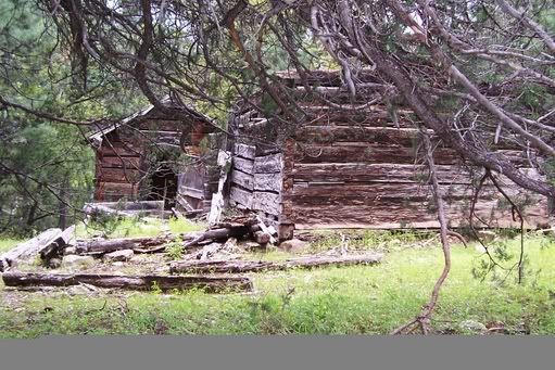
As early as 1822 the site is reported to have been a mining camp, surviving through the 1880s as a supply center for prospectors. It is located near Copper Creek, today there are old log cabins and a corral on the site.[2] In 1883 the town had a post office.[3] Clairmont is noted by historians as having been a significant mining community.[4]