
| Chignik Bay Seaplane Base | |
| Iata: | KBW |
| Faa: | Z78 |
| Type: | Public |
| Owner: | Public domain |
| City-Served: | Chignik, Alaska |
| Elevation-F: | 0 |
| Elevation-M: | 0 |
| Coordinates: | 56.2956°N -158.4014°W |
| Pushpin Map: | USA Alaska |
| Pushpin Map Caption: | Location of airport in Alaska |
| Pushpin Label: | Z78 |
| R1-Number: | E/W |
| R1-Length-F: | 6,000 |
| R1-Length-M: | 1,829 |
| R1-Surface: | Water |
| R2-Number: | NE/SW |
| R2-Length-F: | 10,000 |
| R2-Length-M: | 3,048 |
| R2-Surface: | Water |
| Stat-Year: | 2006 |
| Stat1-Header: | Aircraft operations |
| Stat1-Data: | 210 |
| Footnotes: | Source: Federal Aviation Administration[1] |
Chignik Bay Seaplane Base is a public-use seaplane base serving Chignik, a city in the Lake and Peninsula Borough of the U.S. state of Alaska.
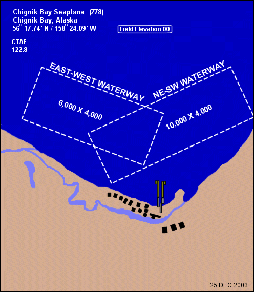
Chignik Bay Seaplane Base has two seaplane landing areas: the E/W waterway is 6,000 by 4,000 feet (1,829 x 1,219 m) and the NE/SW waterway is 10,000 by 4,000 feet (3,048 x 1,219 m). The beach is used for aircraft pull-up. For the 12-month period ending December 31, 2006, the airport had 210 aircraft operations, an average of 17 per month: 95% general aviation and 5% air taxi.