
| Beit Kahil | |
| Translit Lang1: | Arabic |
| Translit Lang1 Type: | Arabic |
| Translit Lang1 Info: | بيت كاحل |
| Translit Lang1 Type1: | Latin |
| Translit Lang1 Info1: | Bayt Kahil (official) Beit Kaheel (unofficial) |
| Type: | Municipality type C |
| Pushpin Map: | Palestine |
| Pushpin Map Caption: | Location of Beit Kahil within Palestine |
| Coordinates: | 31.5697°N 35.0661°W |
| Grid Name: | Palestine grid |
| Grid Position: | 156/108 |
| Subdivision Type: | State |
| Subdivision Name: | State of Palestine |
| Subdivision Type1: | Governorate |
| Subdivision Name1: | Hebron |
| Established Title: | Founded |
| Unit Pref: | dunam |
| Area Total Km2: | 5.8 |
| Area Total Dunam: | 5795 |
| Population Footnotes: | [1] |
| Population Total: | 8880 |
| Population As Of: | 2017 |
| Population Density Km2: | auto |
| Blank Name Sec1: | Name meaning |
| Blank Info Sec1: | "House of the occulist"[2] |
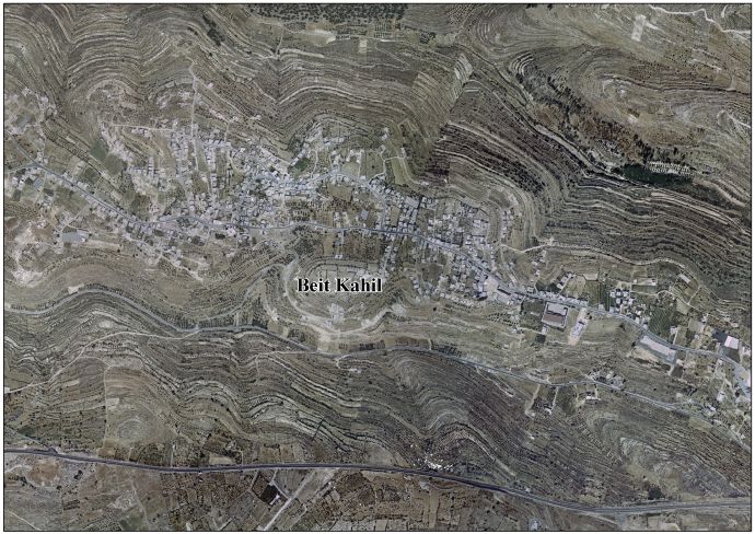
Beit Kahil (ar|بيت كاحل) is a Palestinian village in the Hebron Governorate in the southern West Bank, located seven kilometers northwest of Hebron. The village had a population of 8,880 in 2017.
Victor Guérin noted that the place was apparently ancient, and suggested that Beit Kahil was to be identified with the Roman-period city known in Latin as Cela (Greek: Κηλά), described by Eusebius in his Onomasticon, rather than with the Biblical Keilah (Greek: Κεειλά), which was already a ruin in Guérin's time.[3] [4]
Oral tradition suggests that Beit Kahil was founded after the 16th century.[5]
In the 16th century, Beit Kahil functioned as a mazra'a (farm). It became inhabited with people from Bayt Jibrin, likely as a result of local conflicts. Bedouin settlers, possibly from Jamrura, also took residence there. The establishment of a permanent village dates back to around the mid-19th century.[6]
Ben-Zvi wrote that the local inhabitants were originally Christians and converted to Islam around 150 years prior to his writing in the 1920s.[7]
In the Ottoman census no. 289, (961 AH/1553-1554 CE) p. 209; Bayt Khalil was located in the nahiya of Halil, and noted as Mazra’a (cultivated) land.[8]
In 1863 Victor Guérin found that it had thirty houses,[4] while an Ottoman village list from about 1870 counted 8 houses and a population of 22, though the population count included men only.[9] [10]
In 1883 the PEF's Survey of Western Palestine (SWP) described Beit Kahel as “a small village on a ridge, built of stone, with a well to the south. Apparently an ancient place, with rock-cut tombs.”[11]
In the 1922 census of Palestine, conducted by the British Mandate authorities, Beit Kahil had a population of 336 inhabitants, all Muslims,[12] increasing in the 1931 census to 452, still entirely Muslim, in 90 inhabited houses.[13] In the latter census it was counted with Kh. Beit Kanun, Kh. Hawala and Kh. Tawas.[13]
In the 1945 statistics the population of Beit Kahil was 570 Muslims,[14] and the total land area was 5,795 dunams of land according to an official land and population survey.[15] Of this, 1,359 dunams were plantations and irrigable land, 1,785 were for cereals,[16] while 26 dunams were built-up (urban) land.[17]
In the wake of the 1948 Arab–Israeli War, and after the 1949 Armistice Agreements, Beit Kahil came under Jordanian rule.
The Jordanian census of 1961 found 704 inhabitants in Beit Kahil.[18]
Since the Six-Day War in 1967, Beit Kahil has been under Israeli occupation. Since 1995, it has been governed by the Palestinian National Authority (PNA) as part of Area B of the West Bank.
According to the Palestinian Central Bureau of Statistics, Beit Kahil had a population of approximately 6,526 inhabitants in 2007.[19] The population is made up of several clans, including al-Attawna, al-Assafra, al-Zuhoor, al-Judi, Barham and al-Khateeb. The village's total land area is 5,795 dunams.[20]
In August, 2019, Israeli authorities detained two individuals from Beit Kahil who were accused in the murder of Dvir Sorek; a 19-year-old Israeli settler.[21] [22] In October the detainees were indicted, and in November the IDF demolished the homes of the families of the two detainees, alongside those of two others charged in connection with the murder, in Beit Kahil.[23] The criminal case was resolved two and a half years later, in May 2022, when all four men, together with a fifth, were convicted by military court.[24] [25]
In September, 2019, the deputy mayor and his son in addition to two other people from Beit Kahil were detained in mass arrest over the West Bank.[26]
. Victor Guérin. Description Géographique Historique et Archéologique de la Palestine. 1: Judee, pt. 3. 1869. L'Imprimerie Nationale. Paris. French.
. Village Statistics of 1945: A Classification of Land and Area ownership in Palestine. Sami Hadawi. 1970. Palestine Liberation Organization Research Centre.
. Edward Henry Palmer. 1881. The Survey of Western Palestine: Arabic and English Name Lists Collected During the Survey by Lieutenants Conder and Kitchener, R. E. Transliterated and Explained by E.H. Palmer. Committee of the Palestine Exploration Fund.